You can dip your paddle into “Lake Manly” in Death Valley National Park. This photo was taken February 9, 2024/NPS, Michael Kohler
Now’s your chance — possibly that once in a lifetime chance — to paddle your kayak in Death Valley National Park, the driest place in North America.
A temporary lake on the floor of the national park that formed last year when remnants of Hurricane Hilary flooded the park has been rejuvenated a bit by recent rains.
“You might think with no drain to the sea, that Death Valley would always have a lake,” said Ranger Abby Wines. “But this is an extremely rare event. Normally the amount of water flowing in is much less than the evaporation rate.”
Badwater Basin lies at the bottom of Death Valley. At 282 feet below sea level, it is the lowest elevation in North America. Badwater Basin is normally a dry salt flat.
The magic ingredient this year was rain—and lots of it. Death Valley National Park averages about two inches of rain per year. The valley floor received 4.9 inches in the past six months, and surrounding mountains received greater amounts of rain. Most of that precipitation happened in two events: 2.2 inches during the remnants of Hurricane Hilary on August 20 and 1.5 inches during an atmospheric river February 4-7.
“The lake was deep enough to kayak for a few weeks after Hurricane Hilary, but unfortunately people couldn’t come enjoy it then,” said Wines. “Every road in the park was damaged by flash floods, and it took two months to open the first road into the park. Now most of the main roads are open, so it’s a great time to come visit!”

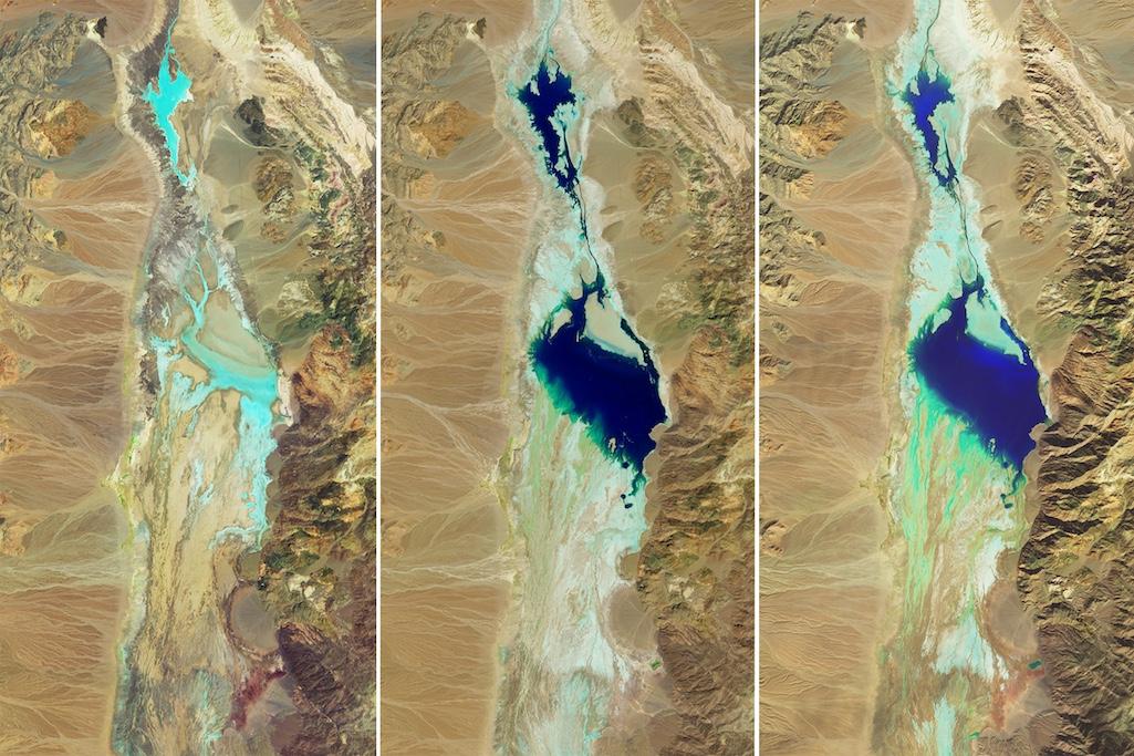
False-color satellite images of Badwater Basin in Death Valley National Park. The light blue areas are damp, and dark blue is standing water. From left to right, they are July 5, 2023 (before Hurricane Hilary), August 30, 2023 (ten days after Hurricane Hilary), and February 14, 2024 (one week after atmospheric river).
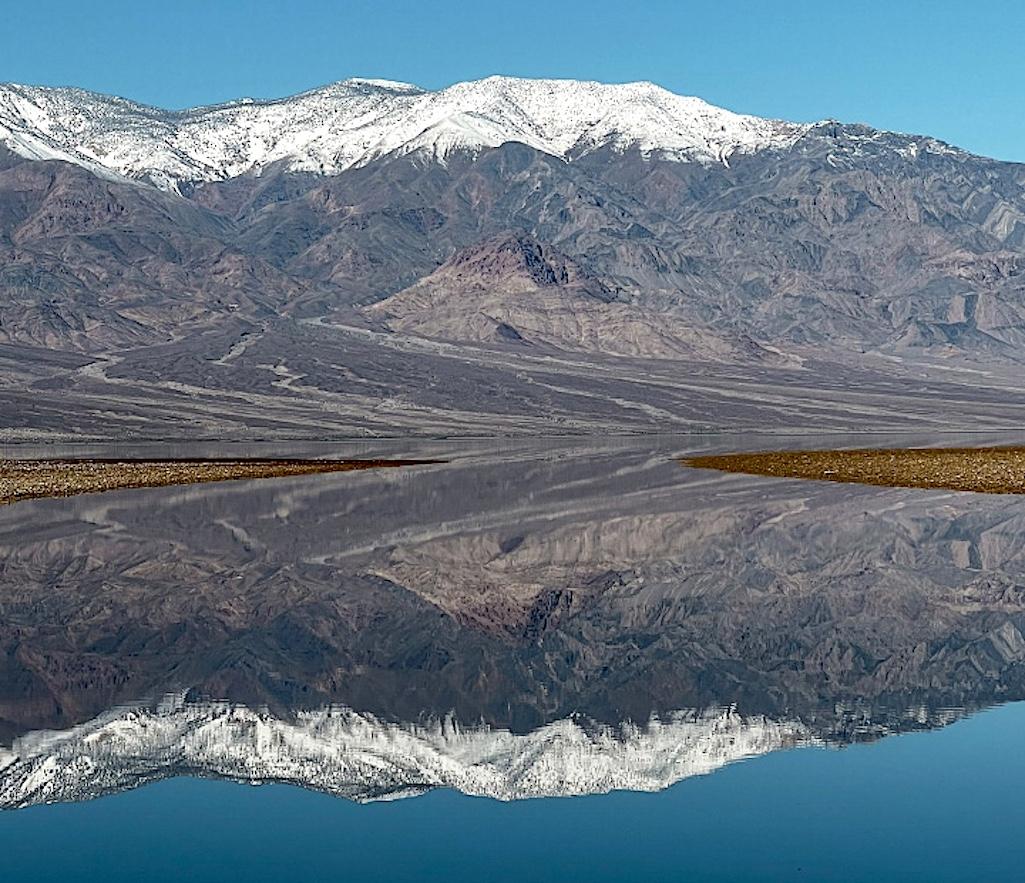
As of mid-February, the temporary lake, informally known as Lake Manly, is about six miles long, 3 miles wide and one foot deep. It may only be deep enough to kayak for a couple weeks. However, park rangers believe the shallow lake will still create beautiful reflections through April.
Park rangers urge visitors to stay safe and to minimize their impact by following a few rules. Parking lots may be full. If parking on a road shoulder, drivers should be cautious of soft shoulders and ensure they are fully out of the driving lane. Footprints in the lakeshore can last for years. People should walk on established pathways.
All hotels and most campgrounds in the park are open. Paved roads are open to most of the park’s primary features, including the temporary lake in Badwater Basin. The National Park Service is continuing to work on secondary roads, many of which are still closed due to flood damage.

The Panamint Range reflected in “Lake Manly.”/USGS


